

|
| CANADA | | | UNITED STATES OF AMERICA |
| ONTARIO | | | NEW YORK |
| Niagara Regional Municipality | | | Niagara County |
 ← map
← map
|
Niagara Falls | map →

|

|
The The first description of the falls was published in 1697 by the Belgium-born missionary Louis Hennepin in his book "Nouvelle Découverte d'un très grand Pays, situé dans l'Amerique entre le Nouveau Mexique et la mer Glaciale". Hennepin, who was with the expedition of the French explorer René-Robert Cavelier, Sieur de la Salle, had seen the Falls for the first time on December 7, 1678. It is, however, not clear whether Hennepin was actually the first European to see the falls. Some claim that either the explorer Étienne Brûlé or the missionary Joseph de la Roche-Dallion, who came to this area already in 1626, were the first European to view the falls. The French named the river "Niagara" in an attempt to transcribe the Indian (Iroqois) word "Onguiaahra", meaning "the strait". A more romantic explanation, "thundering waters", is also frequently given. "Niagara" as the name of the river was first mentioned in a document of 1641. |

|
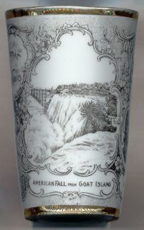
|
The Niagara River is the natural link between Lake Erie and Lake Ontario. It drains an area of approximately 264,000 square miles
(684,000 km2), the equivalent of France, Belgium and the former West Germany together.
The river is only 36 miles (56 km) long, but the difference in elevation is 326 ft (99 m).
More than half of the drop (170 ft, 52 m) occurs at the falls.
The Falls of the Niagara river originated about 12,000 years ago—and about 7 miles (11 km) downstream of their current location, at Niagara Escarpment. From this location the falls moved upstream at varying speads depending on the composition of the rocks. Until the 1950's the erosion by the tumbling waters caused an upstream movement of the falls by about 3 feet (1 m) each year. At the time of their discovery by the first Europeans, some 300 years ago, the falls that these explorers had seen were thus located some 900 feet (300 m) further downstream. Since the construction of hydroelectric power plants, which divert a considerable part of the waters of the Niagara river, the erosion has decreased to only about 1.5 inch (about 3.5 cm) per year. It is estimated that at this speed the falls will reach Lake Erie in about 10,000 years from now. |
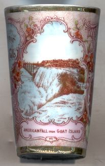
|
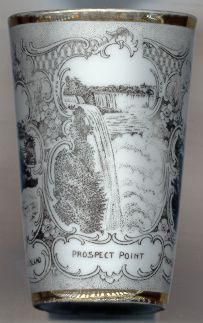
| The amount of water flowing over the American Falls is estimated at about 150,000 US gallons (about 570 cubic meters) per second, the flow over the Canadian (Horse Shoe) Falls is about 600,000 US gallons (2,300 cubic meters) per second. The depth of the river below the Canadian Falls is estimated at 184 feet (56 m)—more than the height of the cascade itself. Twelve million tourist visit the falls each year and are impressed by the spectacle. Only few, however, realize that the flow of water is controled by diversions to hydroelectric power plants upstream. Between June and August only about 50% of the water of the Niagara river flows over the falls, the remaining part is diverted to the Sir Adam Beck #2 Generating Station, built in 1954 on the Canadian side of the river, and the gigantic Robert Moses Niagara Power Plant, constructed in 1961 on the American side. The International Control Works, built in 1954–1963, spread the remaining flow evenly over the crest line of the falls. During the night and out of the tourist season even less water (only 25%) is allowed to flow over the falls. N evertheless, the Niagara Falls are the world's second-largest waterfalls next to the Victoria Falls of the Zambezi river in southern Africa. |

|
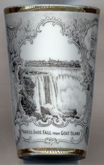
| Only once in modern history the flow of both falls stopped almost completely. On March 12, 1848 an ice jam at the mouth of the river at Lake Erie caused an almost complete stop of the river for some 40 hours. In 1969 the eastern arm of the river supplying the American Falls was diverted completely by a dam for several months because the authorities wanted to investigate the possibility of removing the rocks at the foot of the falls and thus enhancing their appearance. The plans, however, were quickly abandoned due to the enormous costs that would have been involved. There are also some deliberations on whether or not to allow all of the river water to flow down the falls at least once each year so that at least for a short period people could experience the full force of the falls as they existed for thousands of years. On the other hand, this would cause huge damages to landings for boats and other constructions since the water level of the river downstream would rise about 10 feet (3 m). |
|
![[scale]](lineal.jpg)