
|
|
| ÖSTERREICH | AUSTRIA |
| Bundesland: Niederösterreich | Lower Austria |
| Bezirk: Horn |
map →

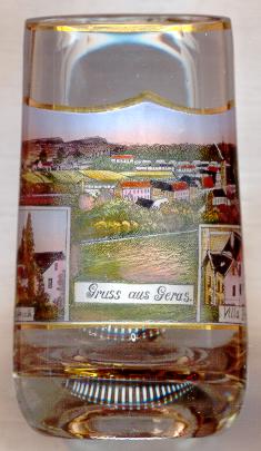
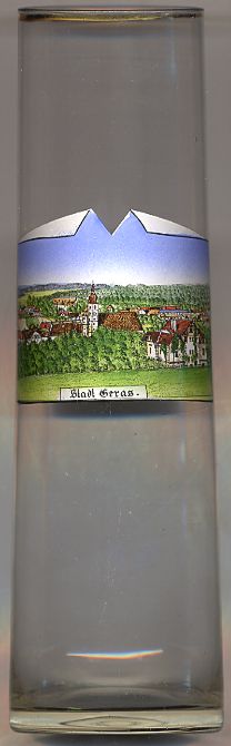 Geras is situated at an elevation of 460 m in the northeastern part of the Waldviertel region of Lower Austria close to the border to the Czech Republic.
The history of Geras is closely tied to that of the Premonstratensian Canons' monastery which was founded in 1153, originally as a double monastery (Geras-Pernegg).
Geras obtained the status of a town in 1928.
Geras is situated at an elevation of 460 m in the northeastern part of the Waldviertel region of Lower Austria close to the border to the Czech Republic.
The history of Geras is closely tied to that of the Premonstratensian Canons' monastery which was founded in 1153, originally as a double monastery (Geras-Pernegg).
Geras obtained the status of a town in 1928.
The  monastery church Mariä Geburt (Nativity of Our Lady) [right, no. 2645: centre]
goes back to the Romanesque period. The church was later rebuilt in Gothic style.
In the 18th century the church was again remodeled in Baroque style by the architect Josef Munggenast and the fresco painter Franz Zoller.
monastery church Mariä Geburt (Nativity of Our Lady) [right, no. 2645: centre]
goes back to the Romanesque period. The church was later rebuilt in Gothic style.
In the 18th century the church was again remodeled in Baroque style by the architect Josef Munggenast and the fresco painter Franz Zoller.
The small insets on the picture on glass no. 935 [left] are labeled
Pfaffenreith Villa Braun
![[scale]](lineal.jpg)