
|
|
| ČESKÁ REPUBLIKA | CZECH REPUBLIC |
| Liberecký kraj | Liberec region |
| Okres: Jablonec nad Nisou |
map →

 Velké Hamry (German: Groß Hammer) is situated at an elevation of 419 m in the Kamenice valley in the southeast
of the Jizera Mountains, about 11 km east of the district town Jablonec nad Nisou and about 20 km southeast
of the regional capital, Liberec. The municipality has a population of about 2,700 (2023).
Velké Hamry (German: Groß Hammer) is situated at an elevation of 419 m in the Kamenice valley in the southeast
of the Jizera Mountains, about 11 km east of the district town Jablonec nad Nisou and about 20 km southeast
of the regional capital, Liberec. The municipality has a population of about 2,700 (2023).
The first iron hammers in the Kamenice valley and on the southeastern slope of the Schwarzbrunn ridge probably originated in the 13th and 14th centuries, but written records from this period are lacking. In 1844, the first textile factory was founded in Swarow, becoming one of the most important textile companies in the Austro-Hungarian empire and later Czechoslovakia. Further factories settled along the river. In 1914, the communities of Ober-Hammer and Unter-Hammer were united to form the municipality of Hammer, which was elevated to the status of the market town of Groß-Hammer in 1926. Following the Munich Agreement, Groß-Hammer was incorporated into the German district of Gablonz (Jablonec nad Nisou) in 1938, resulting in the resettlement of the Czech population. In 1942, neighbouring communities were incorporated into the municipality of Großhammer, but this was reversed after the end of World War II in 1945 and the majority of the German population was expelled. Bohdalovice and Svárov were finally incorporated into the municipality in 1947. Velké Hamry obtained the formal status of a town in 1968.
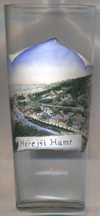
Glass no. 4880 shows a view of Hořejší Hamr (Hoření Hamr; German: Ober Hammer),
which is part of the municipality of Velké Hamry.
[https://de.wikipedia.org/wiki/Velk%C3%A9_Hamry;
http://www.genea.cz/index.php?id=58&did=81629]
![[scale]](lineal.jpg)