
|
|
| DEUTSCHLAND | GERMANY |
| Bundesland: Sachsen-Anhalt | Saxony-Anhalt |
| Landkreis: Salzlandkreis |
map →

Staßfurt is situated at an elevation of 73 m on the river Bode, about 13 km northwest of the district town Bernburg (Saale) and about 29 km south of Magdeburg, the capital of Germany's state of Saxony-Anhalt. The municipality has a population of about 23,500 (2023).
The first written mention of Starasfurt dates from 806 and refers to the village that today is named Alt-Staßfurt. The
name likely derives from a combination of the Old Slavic word staraja ('old') and the Old High German furt ('ford').
Staßfurt's importance in the Middle Ages was due to its location at this ford through the river Bode. The old trade and salt route
coming from Lüneburg crossed the river here to lead on to Halle/Saale.
Alt-Staßfurt to the north of the river was under the secular and ecclesiastical control of the Archbishopric of Magdeburg.
In the 11th century, the castle was built south of the Bode. As early as 1180, the Staßfurt settlement area south of the Bode
was granted town rights. The town was a secular possession of the Anhalt counts until 1277. The descendents of the counts, the dukes of
 Saxony, had to pawn off the town to the archbishopric of Magdeburg in 1276 and as they were not able to repay the loan, Staßfurt
became part of the archbishopric in 1277. From 1680, Staßfurt was directly subordinate to the Brandenburg-Prussian Duchy of Magdeburg
as a so-called ‘Immediatstadt’ and was part of the Holzkreis district until 1807. From 1815, Alt-Staßfurt and the town of Staßfurt
in the administrative district of Magdeburg belonged to the province of Saxony and thus remained on Prussian territory until the dissolution
of the Prussian state in 1947.
Saxony, had to pawn off the town to the archbishopric of Magdeburg in 1276 and as they were not able to repay the loan, Staßfurt
became part of the archbishopric in 1277. From 1680, Staßfurt was directly subordinate to the Brandenburg-Prussian Duchy of Magdeburg
as a so-called ‘Immediatstadt’ and was part of the Holzkreis district until 1807. From 1815, Alt-Staßfurt and the town of Staßfurt
in the administrative district of Magdeburg belonged to the province of Saxony and thus remained on Prussian territory until the dissolution
of the Prussian state in 1947.
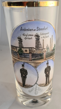
Staßfurt was the birthplace and cradle of global potash mining on 31 January 1852, when the former
 Royal
Royal
[https://de.wikipedia.org/wiki/Sta%C3%9Ffurt, https://en.wikipedia.org/wiki/Sta%C3%9Ffurt]
![[scale]](lineal.jpg)