
|
| SVERIGE | SWEDEN |
| län: Västmanlands län |

 Sala is situated at an elevation of 43 m at the river Sagån in Västmanland County, about 35 km north
of the county's seat, Västerås, and about 106 km northwest of Sweden's capital, Stockholm.
Sala has a population of about 13,100 (2015) and is the administrative seat of Sala municipality with a population of about 22,900 (2016).
The small town is best known for the historic Sala Silver Mine, which is located about 2.7 kilometres southwest of the town. It dates back to at least Medieval times, and was in operation until 1908. In 1624, the town of Sala was moved to its current location close to the mine and at the same time obtained the privileges of a city. The mine eventually reached a depth of 300 metres and a total heading length of 19 km.
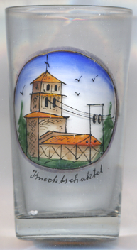
Glass no. 4597 [left] shows a view of the
 Knekt
Knekt
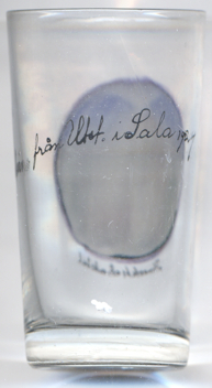
The inscription on the back of the glass reads Minne från Utst[ällning] i Sala 1924 ('souvenir from the Exhibition in Sala 1924'), referring
to the 300-year anniversary of Sala in that year.
[https://de.wikipedia.org/wiki/Sala_(Schweden), https://de.wikipedia.org/wiki/Sala_(Gemeinde), https://en.wikipedia.org/wiki/Sala,_Sweden;
http://www.fallingrain.com/world/SW/25/Sala.html;
https://www.flickr.com/photos/foje64/4362038195]
![[scale]](lineal.jpg)