
|
| SCHWEIZ / SUISSE / SVIZZERA / SVIZRA | SWITZERLAND |
| Zürich / Zurich / Zurigo / Turitg |


 Wetzikon is situated at an elevation of 535 m a the southern end of Lake Pfäffikon
in the district Hinwil of the Swiss canton Zurich. The municipality has a population of about
24.600 (2016).
The earliest written document mentioning Wenzinchofa dates from 1044. The first church was consecrated presumably around 1330 by the bishop of Konstanz. The municipality of Wetzikon emerged in 1798 based on the territory of the Protestant parish. It was part of the district Uster (1798), the bailiwick of Grüningen (1814) and the district Hinwil (since 1831). In the 19th century, the villages of Oberwetzikon, Unterwetzikon, Kempten, Robenhausen, Ettenhausen and Robank formed autonomous civil communities; these were dissolved in 1928 and today are part of the municipality of Wetzikon.
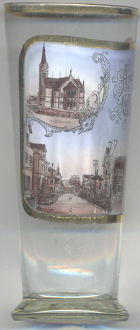
The  Reformed Church [left, no. 2502, and right, no. 3466: top left inset]
goes back to a church that was first mentioned in 857/858 as Ratpoldeschirichun (church of St. Ratpold). This
church seems to have been replaced by another one before 1334. In the early 16th century it became Protestant. The
present church was built in 1895–1897 by the architect Paul Reber in Gothic revival style.
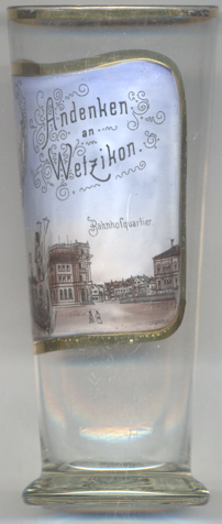
Glass no. 3466 [right] shows a view of
 Bahnhofquartier
[https://de.wikipedia.org/wiki/Wetzikon;
http://www.hls-dhs-dss.ch/textes/f/F93.php;
https://de.wikipedia.org/wiki/Glatthalbahn]
![[scale]](lineal.jpg)