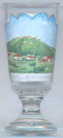

|
| ÖSTERREICH | AUSTRIA |
| Bundesland: Niederösterreich | Lower Austria |
| Bezirk: Krems an der Donau |
 Furth bei Göttweig is situated at an elevation of 214 m at the eastern edge of the Dunkelsteiner Wald mountains,
about 4 km south of Krems an der Donau.
The earliest document mentioning Furth is the deed of foundation of the monastery of Göttweig, dating from about 1138. Further cadastral districts of the municipality are Palt (mentioned first in 1309), Aigen (founded around 1300), Steinaweg, Oberfurcha (founded in 1251), Kleinwien (presumably the oldest part of Furth). Together with Aigen and Palt, Furth became an independent parish in 1748 when it was separated from Mautern.
Another glass in this collection is a souvenir from Fürth in Bavaria, Germany.
![[scale]](lineal.jpg)