
|
|
| ČESKÁ REPUBLIKA | CZECH REPUBLIC |
| Ústecký kraj | Ústí nad Labem region |
| Okres: Děčín |
map →

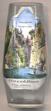
 The gorge, Edmundova soutěska (German: Edmundsklamm), is located east of Hřensko in the
České Švýcarsko (Bohemian Switzerland) region of the Děčín district of northern Bohemia.
The gorge, Edmundova soutěska (German: Edmundsklamm), is located east of Hřensko in the
České Švýcarsko (Bohemian Switzerland) region of the Děčín district of northern Bohemia.
The gorge was formed by the river Kamenice (Kamnitz) and is the lowest of three gorges on the river. Its sandstone walls have a height of 50–150 m above the water level. The gorge was inaccessible until the 19th century. It was only in 1877 that a group of five adventurers managed to raft down the river. In 1898 Prince Edmund Clary-Aldringen, one of the leading aristocrats in Bohemia and owner of large parts of the area, decided to have the gorge developed for public access. That part of the river where no path could be built on its banks where made accessible by the construction of a dam that retained the water. Visitors could then take a boat ride up to the upper parts of the gorge. The gorge, also called Tichá soutěska ('quiet gorge', Stille Klamm), was named for Prince Clary-Aldringen and was opened to the public in 1890. In 1898 the Divoká soutěska ('wild gorge', Wilde Klamm) also was made accessible.
Glass no. 4720 [left] shows a view of the gorge with (on the left side) four rock formations that are identified
(here in German) by their popular names, the  Klammfamilie
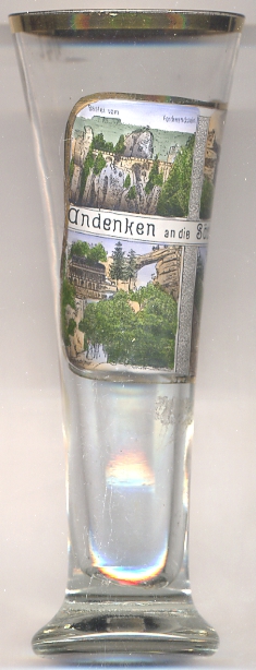
Another popular tourist attraction in the České Švýcarsko (Bohemian Switzerland) region
is the Pravčická brána (Prebischtor).
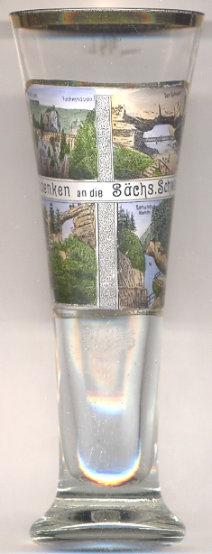
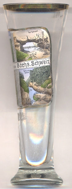
Glass no. 2973, labeled as a souvenir from the Sächsische Schweiz ('Saxon Switzerland' region in Saxony, Germany),
shows a view of Edmundova soutěska (Edmundsklamm in German) [bottom right]
and Pravčická brána (Prebischtor) [bottom left]
as well as of Bastei-Brücke [top left] and Kuhstall [top right] in Germany.
![[scale]](lineal.jpg)