
|
| HRVATSKA | CROATIA |
| županija: Sisačko-moslavačka |

 Topusko is situated at an elevation of 114 m in the Sisačko-moslavačka voivodship of central Croatia,
about 65 km south of the country's capital, Zagreb.
Topusko has a population of about 3,200 (2001).
The earliest settlements were built by the Celts and the Illyrians. Later the area was conquered by the Romans. In the period between the 4th and the 10th centuries, the region suffered from the invasions by Goths, Langobards, Slavs, Avars, Carolingians and later Hungarians. A Cistercian monastery was founded here in the 13th century but was abandoned when the area was threatened by the Turkish invasions. In 1556, the Turks succeeded to conquer Topusko and destroyed the former abbey and monastery. Two years later, emperor Ferdinand I, king of Hungary and Croatia, granted the abbatial rights to the bishop of Zagreb. However, it took until 1784 that the Turks could be repelled, and Topusko was then made part of the Croatian Military Border. For a short period of time at the beginning of the 19th century, Topusko was under French rule (kingdom of Illyria), to be included in the Croatian Military Border again in 1813.
At that time Topusko began to develop as a popular spa town. In 1885 the town and its surroundings were made part of Croatia within the kingdom of Hungary. A modern water supply system and the railway were built at the beginning of the 20th century. Several parks and gardens were constructed at that time, the most famous being the Nikolino Brdo gardens and the Opatovina park. Although Topusko is still recovering from the great damages caused during the 1991–1995 war in Croatia, the town has remained a popular spa place.
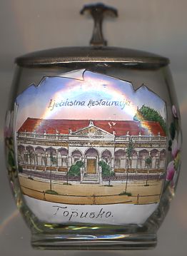
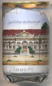
The building depicted on glass no. 2101 [left] is the
 spa
spa
![[scale]](lineal.jpg)